Photos Show Why Los Angeles Fires Were the Worst in City’s History
The ferocity and scale of the fires that tore through the Los Angeles area become clearer in photographs
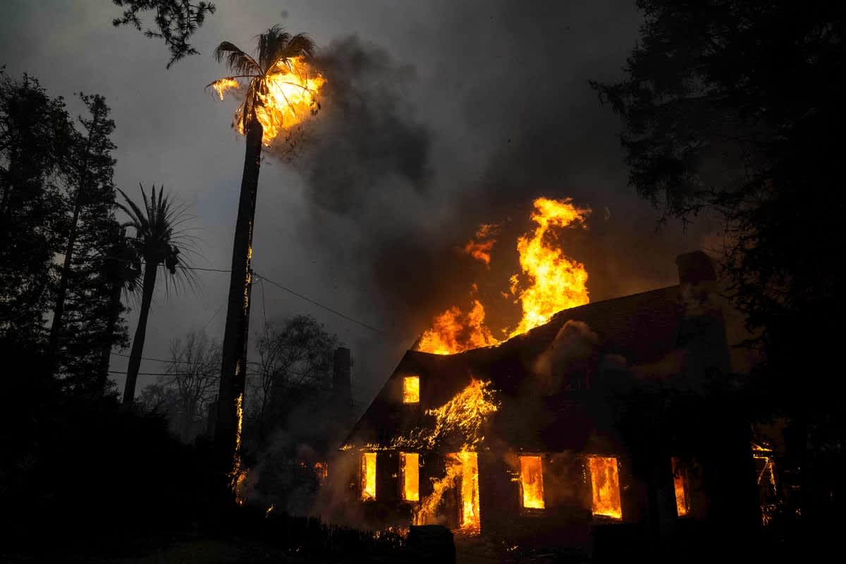
A home on Mariposa Street in Altadena, Calif., goes up in flames during the Eaton Fire on January 8.
Join Our Community of Science Lovers!
In a matter of hours, entire blocks of the Los Angeles area were destroyed, gutting thriving communities and leaving thousands with only the items they carried as they ran from their homes to escape fast-moving fires. More than 10,000 structures have burned across some 35,000 acres in the region.
The blazes were driven by unusually extreme Santa Ana winds that turned brush fires into infernos: these winds rush down from the interior desert through narrow mountain canyons, and in this case, they reached hurricane-force levels in some places. In the face of such ferocious winds and the spot-fire-igniting embers they blow, there is little firefighters can do beyond conducting rescue operations and saving individual structures.
The catastrophes—likely some of the most destructive and costly fires to have ever hit the state of California—are also the product of an overlap between the Santa Ana wind season and a very warm, dry start to winter. The cold season is normally when rains come and tamp down fire risk. This overlap is becoming increasingly likely with climate change.
If you’re enjoying this article, consider supporting our award-winning journalism by subscribing. By purchasing a subscription you are helping to ensure the future of impactful stories about the discoveries and ideas shaping our world today.
There have been countless stories of the raging battles fought by firefighters and the damage that has been wrought, but as the adage goes, pictures really tell the story in a way words often can’t. Here Scientific American has rounded up photographs that show some of the key aspects of the Los Angeles–area fires.
Smoke from the Palisades Fire billows out over the ocean on January 8. Both that blaze and the Eaton Fire have generated huge smoke plumes that have left nearby neighborhoods with poor air quality.
Winds during the height of the event reached gusts above 70 and 80 miles per hours in places. Gusts in one part of the San Gabriel Mountains reached 99 mph. The speed of the winds sent embers far ahead of the fire front, igniting spot fires and setting homes, trees and other structures ablaze.
The ferocity of the flames is evident in this photograph of firefighters attempting to battle the Palisades Fire in the Los Angeles neighborhood of Pacific Palisades on January 7. The fast-moving nature of the fire meant there was almost nothing firefighters could do to halt its progress or save the thousands of homes set alight.
Los Angeles County firefighters try unsuccessfully to get water from a hydrant as they battle the Eaton Fire on January 8 in Altadena, Calif. Water demand for fighting the fires was so high that some hydrants were running dry.
An apartment building burns during the Eaton Fire in Altadena on January 8.
The scale of the fires becomes clearer in this infrared satellite image that shows the heat signature of homes and other buildings in Altadena burning from the Eaton Fire.
A man walks by downed power lines in Altadena’s business district on January 8. Some 5,000 structures in the neighborhood burned.
A firefighting helicopter drops water as the Sunset Fire burns in the Hollywood Hills neighborhood of Los Angeles on the evening of January 8. Such water drops were not possible in the Los Angeles area the previous day because of the dangerously high winds.
Homes that were burned by the Palisades Fire are seen on January 9. Whole blocks of houses were nearly wiped out.
Andrea Thompson is an associate editor covering the environment, energy and earth sciences. She has been covering these issues for 16 years. Prior to joining Scientific American, she was a senior writer covering climate science at Climate Central and a reporter and editor at Live Science, where she primarily covered earth science and the environment. She has moderated panels, including as part of the United Nations Sustainable Development Media Zone, and appeared in radio and television interviews on major networks. She holds a graduate degree in science, health and environmental reporting from New York University, as well as a B.S. and an M.S. in atmospheric chemistry from the Georgia Institute of Technology. Follow Thompson on Bluesky @andreatweather.bsky.social
Amanda Stosz is a photo researcher at Scientific American. You can find her on Instagram at @amandastosz
Source: www.scientificamerican.com
