The Crucial Role of Damage Surveys in Tornado Science
Damage surveys provide crucial information about when, where and how strong U.S. tornadoes are to better understand disaster risk
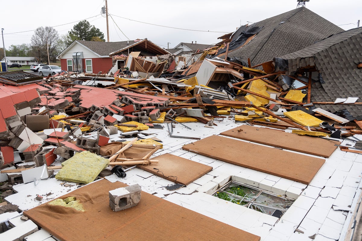
Structural damage is visible at Christ Community Church after a tornado struck on April 3, 2025, in Paducah, Ky.
The U.S. National Weather Service forecasts tornado outbreaks—often days in advance—and issues the watches and warnings that help people know when and how to prepare and when to take cover. NWS researchers also perform another task that is less recognized but crucial: conducting damage surveys in the wake of tornadoes such as those that struck parts of Arkansas, Tennessee, Kentucky and Indiana this week.
To learn more about why these surveys of the devastation wrought by tornadoes is so important, Scientific American spoke with tornado researcher Jana Houser of the Ohio State University.
[An edited transcript of the interview follows.]
If you’re enjoying this article, consider supporting our award-winning journalism by subscribing. By purchasing a subscription you are helping to ensure the future of impactful stories about the discoveries and ideas shaping our world today.
Why do researchers conduct damage surveys after a tornado hits?
With a hurricane, you send a hurricane hunter aircraft in the air, and it drops an instrument package called a dropsonde through the hurricane. That instrument, as it is descending, acquires information about the temperature, the pressure, the winds, the moisture, etcetera. And those wind measurements are what we use to understand how intense the hurricane is.
Tornadoes pose a challenge with this type of technique because they’re very small. They’re also very intense, and they’re very difficult to predict. And oftentimes they don’t occur anywhere where we could even put an instrument in it in the first place. So the best way we have available to us to determine how intense tornadoes are is looking at how much damage is caused by the tornado after the fact.
A lot of people try to argue, “Well, why don’t we use radars, for example, to look at tornadoes?” And the biggest problem with radars is the distance between the radar and the tornado. Also, where the radar is actually measuring in the tornado is not at the ground—it tends to be very high. And there’s not a standard height that we can always get information at, so we cannot compare apples to apples by using radar data.
What does a damage survey involve?
When you actually go to perform a damage survey, the first thing we want to do is figure out where the tornado started causing damage in the first place. So you want to establish a start point, and that is typically informed—at least as kind of a first-order guess—by radar data.
“I’ve seen bits of straw stuck into the concrete berms of sidewalks.” —Jana Houser, tornado researcher
Can you tell us about some of your experiences with damage surveys?
I’ve seen some interesting and kind of frankly gruesome things with these. I think some of the most memorable moments were after the Greensburg, Kan., tornado in May 2007. That was the very first EF5 tornado of the whole new EF scale that happened in 2007 [when it replaced the former Fujita scale].
That was my first real experience with catastrophic tornado damage. The town was just leveled—like, 90 percent of the town just was wiped off the map. There were buildings where the slabs were just basically bare. There was a fire hydrant—I will never forget this—this fire hydrant was literally sucked out of the ground with, I don’t know, at least six feet of pipe. And nothing was bent—it was, like, perfectly straight. That just speaks to the intensity of the vertical winds that happen. You don’t just have horizontal winds in a tornado.
It all depends on the quality of the photograph and what the photographer knows or doesn’t know about damage surveys. If you have someone out there who knows what they’re looking for and is zooming in on, for example, the connections between floor joists and the foundation [which can tell them how much wind a structure should be able to withstand], you can get a pretty good feeling for the damage.
The challenge with photographs is that they’re point sources. You’re not necessarily guaranteeing full time-space coverage, unless they’re really doing thousands and thousands of pictures from different angles.
And then, obviously, the challenge with not getting a damage survey crew out immediately is that people start cleaning up immediately, muddying the waters a little bit.
How crucial is it to always do these surveys?
We could get a false sense that there are fewer tornadoes because we don’t have crews that are actually going out to survey some of these weaker tornadoes. Or, if offices are pressed for time, we might end up actually getting inaccurate EF scale ratings because they are short-staffed and are dealing with limited resources.
This, then, has implications on the big question that everybody wants to know, which is: How are tornadoes changing in a world of a changing climate? If we don’t have adequate data, we can’t answer that question accurately.
Andrea Thompson is an associate editor covering the environment, energy and earth sciences. She has been covering these issues for 16 years. Prior to joining Scientific American, she was a senior writer covering climate science at Climate Central and a reporter and editor at Live Science, where she primarily covered earth science and the environment. She has moderated panels, including as part of the United Nations Sustainable Development Media Zone, and appeared in radio and television interviews on major networks. She holds a graduate degree in science, health and environmental reporting from New York University, as well as a B.S. and an M.S. in atmospheric chemistry from the Georgia Institute of Technology. Follow Thompson on Bluesky @andreatweather.bsky.social
Source: www.scientificamerican.com