Inside the Lifesaving Power of Doppler Weather Radar
If you’re enjoying this article, consider supporting our award-winning journalism by subscribing. By purchasing a subscription you are helping to ensure the future of impactful stories about the discoveries and ideas shaping our world today.
The power of the returning signals lets experts create a picture of size, shape and intensity of any precipitation—and this is what you see on a phone app’s radar map or a TV broadcast.
But NEXRAD can do much, much more than show how hard it’s raining. Within its sphere, each unit rotates and scans up and down through the sky, helping forecasters see what is happening at multiple levels of a storm system. These vertical profiles can show, for example, whether a tornado is forming or a storm is creating a downburst—a rapid downward blast of wind. “Doppler radar basically allows us to see in the clouds,” Hanrahan says.
And then there’s the “Doppler” part itself. The name refers to a phenomenon that’s familiar to many, thanks to the electromagnetic waves’ acoustic counterpart. We’ve all experienced this, often most obviously when we hear an emergency vehicle siren pass nearby: the pitch increases as the car gets closer and decreases as it moves away. Similarly, the returning radar bounce from a rain droplet or piece of tornadic debris that is moving toward the emitter will have a shorter wavelength than the pulse that was sent out, and the signal from an object moving away from the radar will have a longer wavelength. This allows the radar to efficiently distinguish the tight circulation of a tornado.
These two images show how dual-polarization helps NWS forecasters detect a tornado that is producing damage. The left image shows how the Doppler radar can detect rotation. Between the two yellow arrows, the red color indicates outbound wind, while the green color indicate inbound wind, relative to the location of the radar. The right image shows how dual-polarization information helps detect debris picked up by the tornado.
The nation’s radar system was upgraded in 2012 to include what is called dual polarization. This means the signal has both vertically and horizontally oriented wavelengths, providing information about precipitation in more than one dimension. “A drizzle droplet is almost perfectly spherical, so it returns the same amount of power in the horizontal and in the vertical,” Hanrahan says, whereas giant drops look almost like “hamburger buns” and so send back more power in the horizontal than the vertical.
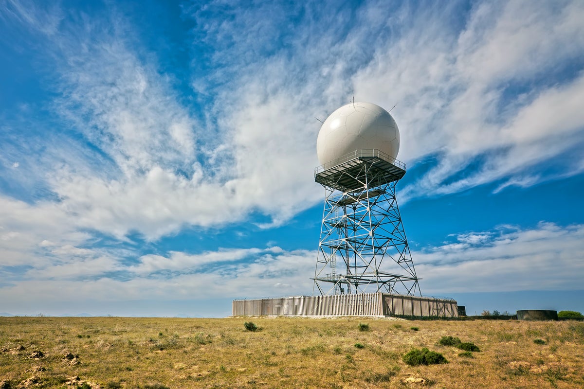
Doppler radars do not pose any danger to people, wildlife or structures—and they cannot affect the weather.
Along the electromagnetic spectrum, it is the portions with shorter wavelengths such as gamma rays and ultraviolet radiation that can readily damage the human body—because their wavelengths are the right size to interact with and damage DNA or our cells. Doppler radars emit pulses in wavelengths about the size of a baseball.
Being hit by extremely concentrated microwave radiation could be harmful; this is why microwave ovens have mesh screens that keep the rays from escaping. Similarly, you wouldn’t want to stand directly in front of a radar microwave beam. Military radar technicians found this out years ago when working on radars under operation, University of California, Los Angeles, climate scientist Daniel Swain said during one of his regular YouTube talks. They “had experiences like the candy bar in their pocket instantly melting and then feeling their skin getting really hot,” he said.
Similar to how a microwave oven works, when the microwave signal from a radar hits a hydrometeor, the water molecules vibrate and so generate heat because of friction and reradiate some of the received energy, says Cynthia Fay, who serves as a focal point for the National Weather Service’s Radar Operations Center. But “microwave radiation is really not very powerful, and the whole point is that if you stand more than a couple dozen feet away from the dome it’s not even really going to affect your body, let alone the global atmosphere,” Swain adds.
At the radar’s antenna, the average power is about 23.5 megawatts (MW) of energy, Fay says. (A weak or moderate thunderstorm may generate about 18 MW in about an hour.) But the energy from the radar signal dissipates very rapidly with distance: at just one kilometer from the radar, the power is 0.0000019 MW, and at the radar’s maximum range of 460 kilometers, it is 8.8 x 10⁻¹² MW, Fay says. “Once you’re miles away, it’s just really not a dangerous amount” of energy, Swain said in his video.
A supercell thunderstorm that produced an F4 tornado near Meriden, KS, in May 1960, as seen from the WSR-3 radar in Topeka (left). A supercell thunderstorm that produced an EF5 tornado in Moore, OK, in May 2013, as seen from a modern Doppler weather radar near Oklahoma City (right).
And Doppler radars spend most of their time listening for returns. According to the NWS, for every hour of operation, a radar may spend as little as seven seconds sending out pulses.
The idea that Doppler radar can control or affect the weather is “a long-standing conspiracy [theory] that has existed really for decades but has kind of accelerated in recent years,” Swain said in his video. It has resurfaced recently with threats to the National Oceanic and Atmospheric Administration radar system from an antigovernment militia group, as first reported by CNN. The Washington Post reported that the group’s founder said that its members were carrying out “attack simulations” on sites in order to later destroy the radars,—which the group believes are “weather weapons,” according to an internal NOAA e-mail. NOAA has advised radar technicians at the NWS’s offices to exercise caution and work in teams when going out to service radars—and to notify local law enforcement of any suspicious activity.
“NOAA is aware of recent threats against NEXRAD weather radar sites and is working with local and other authorities in monitoring the situation closely,” wrote a NWS spokesperson in response to a request for comment from Scientific American.
NOAA’s radars have been on duty for 24 hours a day, seven days a week and 365 days a year since 1988 (with brief downtimes for maintenance and upgrades). “It’s amazing what workhorses these radars have been,” Hanrahan says.
The image on the left shows a reflectivity radar image of a supercell thunderstorm that produced several tornadoes on April 19, 2023, near Oklahoma City, OK. The hook shape present often indicates rotation within the storm. The image on the right show velocity information that corresponds to the reflectivity image. Very strong inbound winds (green colors) are next to very strong outbound winds (bright red/yellow colors). This very strong inbound/outbound “couplet” indicates the very strong rotation of a tornado.
But they do require that periodic maintenance because of all the large moving parts needed to operate them. And with Trump administration cuts to NOAA staffing and freezes on some spending, “we just got rid of a lot of the radar maintenance technicians, and we got rid of the budget to repair a lot of these sites,” Swain said in his video. “Most of these are functioning fine right now. The question is: What happens once they go down, once they need a repair?”
It is this outage possibility that most worries weather experts, particularly if the breakdowns occur during any kind of severe weather. “Radars are key instruments in issuing tornado warnings,” the Ohio State University’s Houser says. “If a radar goes down, we’re basically down as to what the larger picture is.”
And for much of the country—particularly in the West—there is little to no overlap in the areas that each radar covers, meaning other sites would not be able to step in if a neighboring radar is out. Hanrahan says the information provided by the radars is irreplaceable, and the 2012 upgrades mean “we don’t even need to have eyes on a tornado now to know that it’s happening. It’s something that I think we take for granted now.”
Andrea Thompson is an associate editor covering the environment, energy and earth sciences. She has been covering these issues for 16 years. Prior to joining Scientific American, she was a senior writer covering climate science at Climate Central and a reporter and editor at Live Science, where she primarily covered earth science and the environment. She has moderated panels, including as part of the United Nations Sustainable Development Media Zone, and appeared in radio and television interviews on major networks. She holds a graduate degree in science, health and environmental reporting from New York University, as well as a B.S. and an M.S. in atmospheric chemistry from the Georgia Institute of Technology. Follow Thompson on Bluesky @andreatweather.bsky.social
Source: www.scientificamerican.com