The World’s Largest Treasure Hunt Turns 25
These hobbyists use GPS coordinates to hunt for secret prizes around the world
Bryan Roth had been hiking and scrambling for a while, with drop-offs evident around him, when his guides held out coveralls and pointed between two rocks. “We have to go in the hole,” one said.
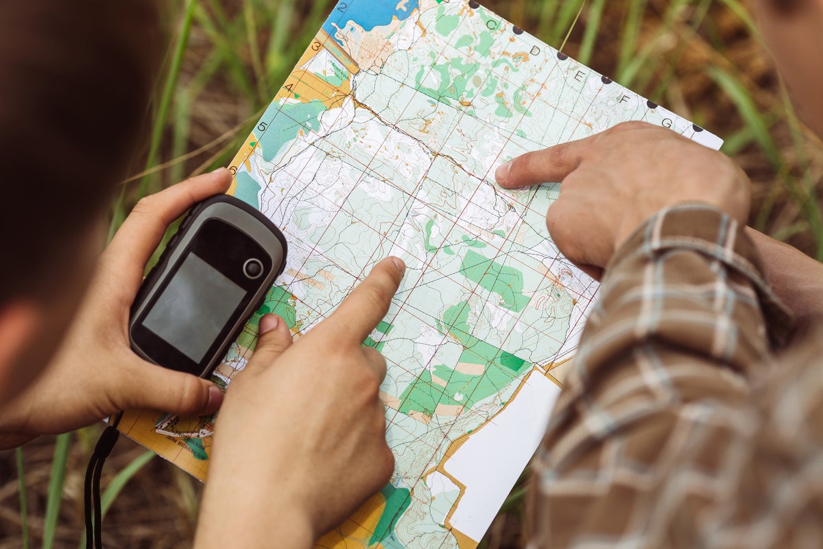
Roth was standing at the edge of a cave in Pirkanmaa, Finland. Inside, he knew, was a geocache: a container that was stashed at a particular latitude and longitude and meant to be sought and found like treasure—in this case, like buried treasure.
If you’re enjoying this article, consider supporting our award-winning journalism by subscribing. By purchasing a subscription you are helping to ensure the future of impactful stories about the discoveries and ideas shaping our world today.
Roth is a geocacher—a person who spends their spare time scouring Earth’s gridded coordinates to find hidden objects. And he’s not just an enthusiast—he’s president of Geocaching HQ, which runs Geocaching.com. Many hobbyists use this site to access a master list of geocaches and log their finds, which they can also do on an app.
Geocaching is possible because of : the set of satellites whose signals can reveal the location of any receiving device down to a few yards. “GPS started as a U.S. military program,” says Brian Weeden, a space policy expert at the Aerospace Corporation’s Center for Space Policy and Strategy. It was meant to help the Department of Defense navigate its ships, planes, land forces and weapons. If those moving things can receive signals from four or more GPS satellites at once, they can calculate their position based on the small difference in when those four-plus signals arrive. The same is true for a smartphone.
The idea for GPS was inspired by Sputnik, the first satellite ever launched. Scientists realized they could use beeps from Sputnik to determine the satellite’s location. “After that, they realized you could reverse the process, and you could use it to track locations on the ground based on a moving signal in space,” says Weeden, who recently wrote a report that analyzed GPS policy decisions throughout history.
That vague idea eventually morphed into the DOD’s GPS network, which is currently a constellation of 31 satellites.
Despite GPS’s military origins, its signals were always available to civilians, Weeden says. But the military initially inserted a deliberate error into those signals, fuzzing up regular people’s positions by about 100 yards.
In 1996 the U.S. government pledged to nix the uncertainty—which it called “selective availability”—within a decade. Uncharacteristically, it did so just four years later, in May 2000. And almost immediately after that, geocaching was born.
At the time, GPS nerds hung out on the nascent Internet, chatting on newsgroups. When selective availability switched off, discussions were buzzing. Dave Ulmer was one of the amped-up Internet talkers. And right after selective availability switched off, he hid a container in the woods, posted its coordinates to one of these forums and waited for people to use their newly precise GPS devices to find his prize: a five-gallon bucket stuffed with map software, videos, books, food, money and a slingshot.
Mike Teague found it just three days later. Intrigued by the idea, he offered to curate a public list of other caches, should anyone place them. They did, and people began to call the idea the Great American GPS Stash Hunt. Later, it was changed to “geocaching” to avoid the vaguely illegal connotations of “stash” and the limitations of “American.”
Jon Stanley, currently a senior data scientist at Geocaching HQ, didn’t start searching for caches right away. Initially there were none near him, but he did hide his own cache about a month after Ulmer, near a cabin his family had in Idaho. “I want to take people to a place that they wouldn’t visit ordinarily,” he says.
A man named Jeremy Irish, one of Roth’s co-founders, came across this so-called stash hunt online and built a website to make the game more accessible, with assistance from Roth and another co-founder, Elias Alvord. Geocaching.com launched in September 2000 and pointed people to the 75 existing caches. “When Mike Teague’s online list went down in September 2000, he told everyone to visit Geocaching.com,” says Roth.Some have criticized the site’s co-founders for commercializing what had been an open-source game—for instance, by selling merchandise and offering a subscription for premium membership.
One of the biggest innovations in GPS itself, Weeden says, is the growth in other satellite navigation systems—such as Russia’s GLONASS, Europe’s Galileo and China’s BeiDou. “That means a lot of devices these days, including your phone, can pull signals from all these constellations, which makes it easier to get a signal and can improve the accuracy,” he says. These systems spit out common civil signals while maintaining separate military ones.
Some, like the one Roth crawled toward in Finland, require special skills. Others call upon rock climbing gear, scuba equipment, kayaks and even helicopters. There’s even a geocache on the International Space Station.
Geocaching.com has also expanded the kinds of caches available. “Instead of hiding boxes,” Roth says, “people are creating multistage, multimedia self-guided tours and experiences”—such as a tree tour at the University of Washington. “We believe every location has a story to tell,” he adds.
Geocachers also do good works, such as reporting coordinates from physical survey markers to the National Oceanic and Atmospheric Administration. A geocache even helped lost hikers in 2008; they accidentally found it and so were able to tell rescuers where they were. Other cachers discovered a remote, recent car crash while searching and helped save the driver.
It’s not all nice stories, though. As with most hobbies, people have died geocaching—falling into ravines, for instance.
The GPS system itself isn’t entirely safe either. Since GPS’s start, new signals have been introduced, Weeden says, so satellites transmit multiple different signals at once—four civilian ones and two military ones. The increase means more accuracy because receivers can compare and contrast them and find out if a given signal is being faked or manipulated. Military signals are even more resistant to interference and jamming, which is necessary because modern conflict, almost by definition, includes one group messing with another’s global positioning signals, whether that means simply blocking signals or spoofing them so that the positions are off. That interference is much more consequential to, say, an aircraft pilot than it is to a geocacher, but it can happen to either one.
So if you’re out searching for a stashed cache, and your signal looks more like one from 1999 than 2005, you can just pay a little homage to those old days of selective availability and spend some time looking at wherever you happen to be, wondering what else might be hidden there and to whom it is special. “Go for the experience,” Stanley says. “You might find things that are disappointing, but keep at it, and you’ll start to see the magic in the places it takes you.”
Sarah Scoles is a Colorado-based science journalist and a contributing editor at Scientific American. Her newest book is Countdown: The Blinding Future of Nuclear Weapons (Bold Type Books, 2024).
If you enjoyed this article, I’d like to ask for your support. Scientific American has served as an advocate for science and industry for 180 years, and right now may be the most critical moment in that two-century history.
I’ve been a Scientific American subscriber since I was 12 years old, and it helped shape the way I look at the world. SciAm always educates and delights me, and inspires a sense of awe for our vast, beautiful universe. I hope it does that for you, too.
If you , you help ensure that our coverage is centered on meaningful research and discovery; that we have the resources to report on the decisions that threaten labs across the U.S.; and that we support both budding and working scientists at a time when the value of science itself too often goes unrecognized.
In return, you get essential news, captivating podcasts, brilliant infographics, , must-watch videos, challenging games, and the science world’s best writing and reporting. You can even gift someone a subscription.
There has never been a more important time for us to stand up and show why science matters. I hope you’ll support us in that mission.
Thank you,
David M. Ewalt, Editor in Chief, Scientific American
Source: www.scientificamerican.com